From airports to subways, the transportation industries see more customer traffic than any other industry in the world. Every day, thousands of people will move through even a single transportation venue. They travel between home and work, shopping, vacation, and meet friends/family for outings. Whether you run a busy bus depot or a bustling train station, one of the most important aspects of traveler enjoyment and station efficiency using maps.
Your transportation units needs to be able to pull in and stop for passenger embarking and disembarking, as well as for maintenance and restocking for the journey. This means that it is in every venue's needs to have a comprehensive and interactive map depicting exactly where each train, bus, plane, or boat should be. When you combine this with a sleek mobile app and a responsive 'you are here' dot, there are a variety of ways to improve your venue with this technology
Directing Passengers to Terminals
For passengers experiencing their first time in a big transport station of any kind, the biggest risk is becoming lost or overwhelmed. When all terminals look like one another, it's all too easy to make a mistake reading a 2D map. But an interactive 3D map can give passengers a clear look at how the building is laid out and how to get from their location to the terminal they need.
If a transportation center creates a mobile app, Concept3D's interactive maps can be integrated into it to help guide and give passengers their exact distance from the terminal. Passengers can use wayfinding to get to their end location as quickly as efficient as possible.

Live Animation of Transportation Arriving or Departing
Of course, many of your customers will be commuters who take the bus or train everyday. Live animation in 3D map can make this not only transparent, but also a delight to watch. With a top-down or even a 3D perspective view of your depot, you can show worried or impatient passengers the exact moment when their bus and train arrive.
This is also a great feature for anyone who wants to get a feel for the flow of your station or who is worried they will miss their ride. People rushing to catch a departure will be relieved to see that you have a live display of which vehicles are still waiting for passengers and which have already pulled out. An easy to control color-key can even indicate the exact moment a vehicle closes its doors and prepares for departure or opens its doors after arrival.
Direct Drop-Off and Pick-Up Traffic
Another major logistics concern for transport stations of any kind is the drop-off zone. People who are either parking and riding or getting a lift from someone else will need a route to drive cars through. Concept3D's interactive maps can highlight not only the exact path, but specific area for pick up and drop off.
For people who would like more help, you could create a virtual tour of the drop off zone. There can be step by step interactive 360° panoramas to guide them through the process. You can add descriptions, drop location pins, and create multiple stops so they know the area front to back.
Help Passengers Find Restaurants and Shops
Of course, almost transportation hub is complete without a few shops that also take the place of customer services. It's beneficial to have a few tables and chairs along with a place for passengers to buy sandwiches, entertainment, and snacks for the road. Souvenir shops, restaurants, and even office services like UPS stores may pop up and they do so because your passengers have created a demand for them.
Part of being a great venue includes helping both your passengers and business tenants out by connecting them through an easy to read map. On your map you can have different tabs separating each type of stores to make it even easier to access. Making your map as easy to read as possible will only make it more helpful. 
Highlight Handicap Accessibility Points
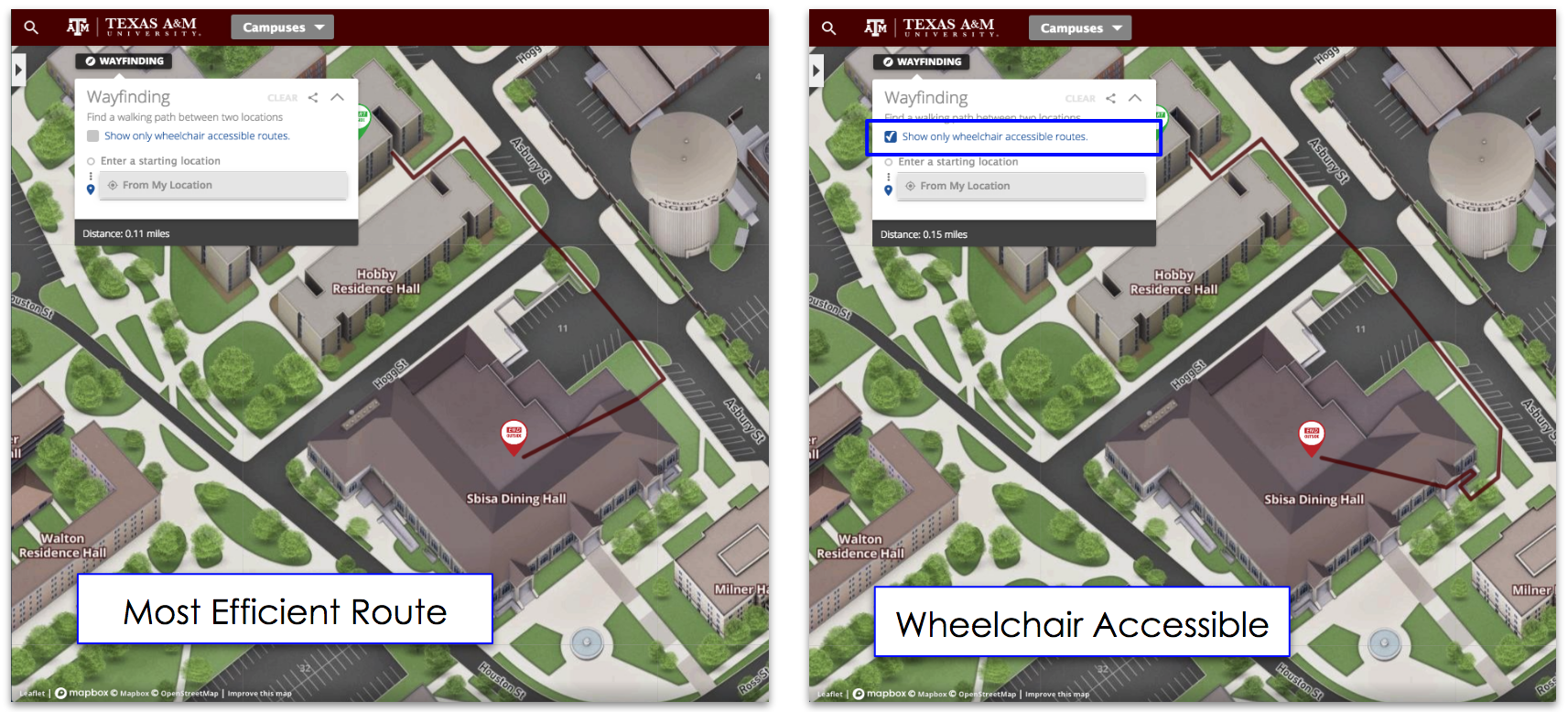
One of the most important design features of any transportation depot is handicap accessibility. As an incredibly public venue, the ADA requires that there be ramps and handrails to assist your handicapped passengers. It is very important to smoothly direct passengers to your ramps and lifts when they are most needed. Concept3D gives you all the tools to make your map ADA compliant
A 3D map can be used to clearly highlight not only where your handicap access points are but also how to get to them.You can install the map on-screen displays, as a feature on your website, or in a mobile app for passengers to carry with them and navigate in real time.
Your Transportation facility can be running more efficiently by be able to track where your vehicles are. It can also make your travelers have a more enjoyable experience with all the features you can add to your map. Overall, your facility will run smoother and create comfortable trip for your travelers. Contact us today to make your transportation center run smoother!
Topics: Live Data Integration, Interactive Virtual Experiences


