Large hospitals can easily compete with popular shopping malls and high-rise office buildings in size and population, but no facility is more challenging to find the correct path than a busy hospital. With the sheer number of parking lots, entrances, separate and connected buildings, departments, and individual offices, it can be nearly impossible for patients, guests, and even new hires to find their way around in a timely manner.
This is why hospitals have always invested in printed and posted maps so heavily. People getting lost is one of the leading hospital inefficiencies in almost every large facility. Navigation is not a skill or talent that everyone possesses, which is why the interactive maps and navigation apps have become so popular for today's drivers.
By following a little blinking dot or a clearly defined pathway, even the most easily turned-around patients can find their ways to appointments on time. But interactive maps aren't just good for your hospital's many patients and visitors.
1) Stop Printing Maps
One of the first costs that an interactive map and mobile app can save you is commercial printing. In order to help people find the correct parking lot, entrance, and their way to key locations, hospitals traditionally print up thousands of maps a year. You can post them all the walls, hand them out to patients, and leave them in available stacks on reception desks, but visitors wills till get lost and the maps wind up littering the waiting rooms and parking lots of your facility. Hospitals can develop an app and have Concept3D integrate their map into it.
Without the need to print (and then dispose of) paper maps, visitors can log into a currently accurate map on their mobiles, then follow glowing wayfinding paths just as they would using GPS driving navigation.

2) Asset Tracking and Supply Locations
When it comes to hospital efficiency, asset tracking is one of the biggest hurdles. For items like wheelchairs, mobile beds, and certain treatment equipment that is in high demand and constant use, being able to actively track the location of each item can significantly reduce the time looking for them. You start with a network of localized sensors and RFID tags that emit a small unique signature for each asset you want to track.
Combine this with an interactive map that your staff mobile devices and workstations can access, and find any asset much more quickly than doing a room and hallway search of the area it's supposed to be in. A moving pinpoint on the map will mark each easy to find the asset.
What's really interesting is that this can be used to quickly locate shelves of supplies as well. Simply by documenting which shelf an item is located on, a staff member in a hurry can do a quick search of the interactive map rather than looking by-hand.
3) Training & Orientation Tours
Being able to navigate the hospital is vital for anyone who will be spending a reasonable amount of time in and between the buildings. This is true whether you're talking about new staff members, patients, or parents of patients. Often, hospital staff will take half an hour or more to give new regulars a thorough tour, but walking the halls and hearing an explanation only sticks for a precious few people.After the tour, no matter how good the tour was, most people will still be terribly lost for their first few days and lose a lot of time asking other members of staff how to get around.
Create a virtual tour for your facility so before people come to visit or work their, they have access to see where everything is. Hospital staff or visitors can use the tour to alleviate stress and anxiety of trying to get around.
4) Procedural Navigation
One of the most complex tasks a patient must perform in a hospital is making their way through a complex sequence of procedures. If they need to see one doctor for a check-up, another room for a test, and another for a follow-up or any number of variations, the route can become complex. Doctors and staff try to help by drawing the route on a paper map but patients and their helpers can still get overwhelmed, confused, and lost.
Wayfinding capabilities can lead patients along with their drivers and family support through a complex directions one step at a time. It can guide them to the right parking lot, in the right entrance, and then from one appointment to the next with no confusing lines and arrows on a map.

5) Safety & Security
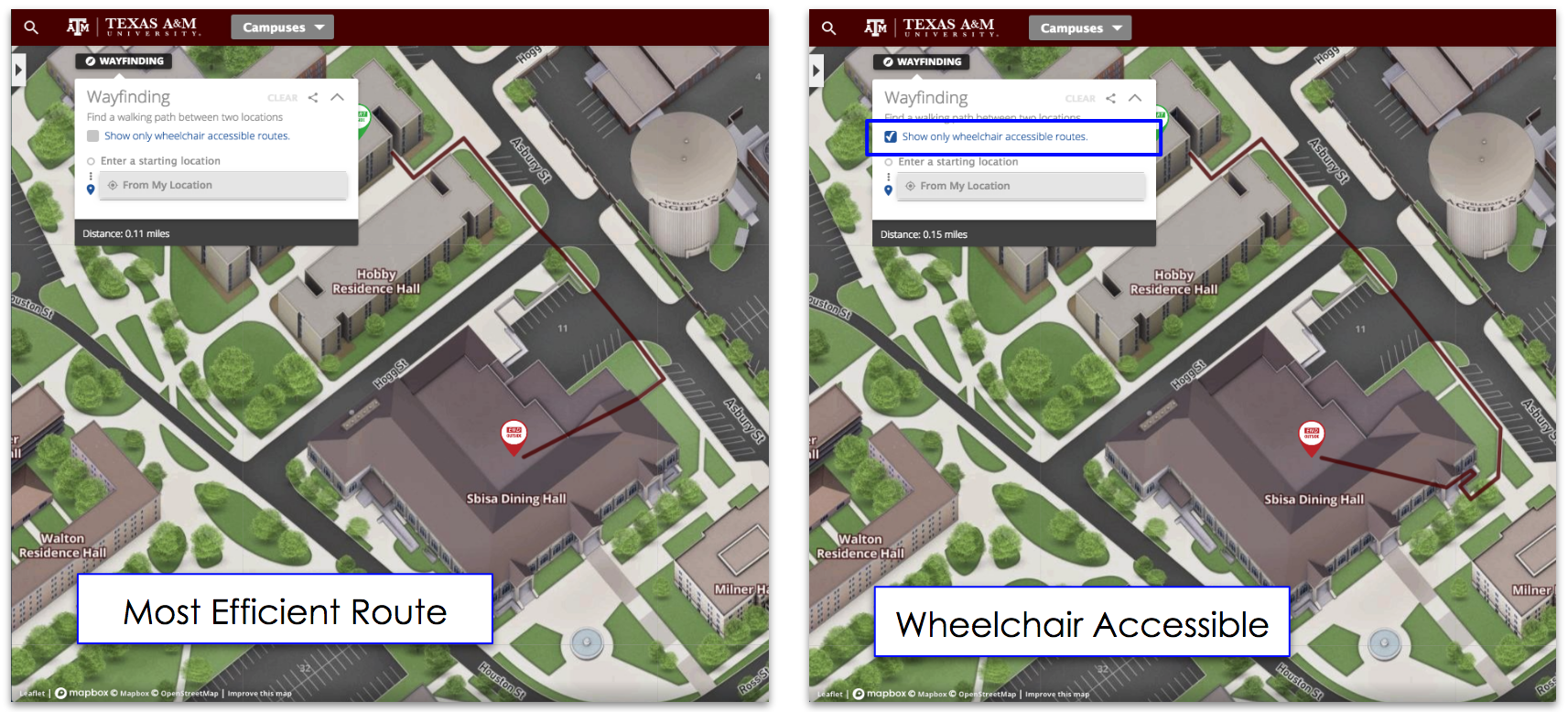
The map can also be used to provide handicap-safe routes for visitors and patients, altering the usual navigation services to always take elevators and ramps. You can even actively update the map to block off and put warnings on areas that are under renovation or closed for procedural purposes. In that emergency situation, you can have preplanned routes attached to your map. Anyone can have access to that emergency plan if they have a mobile phone.
---
Helping people find their way through your hospital buildings and campus is one of the best ways to reduce costs and increase efficiency. From no longer needing thousands of paper maps to asset tracking to fewer missed appointments, interactive maps are the future of hospital management and hospitality. Concept3D can help make your hospital as efficient as possible, contact us today!


