There are so many moving parts in the hospitality industry that keep the show going. Public perception is key, are you showing off your space or your campus grounds to their fullest potential. If somebody was on the outside looking in, would they want to hold or attend a convention at your location, book a conference at your hotel, become a patron of your hospital or nursing home.
Concept3D’s interactive mapping software lets you add a new dimension to how you represent your space that will give you a substantial edge. Furthermore, concept3D’s interactive maps now feature complementary Esri technology that will provide substantial help behind the scenes as well.
3D Renderings add a new dynamic to your maps
Perhaps what concept3D is best known for, 3D renderings provide the viewer with a more informative and aesthetically pleasing vision of your campus grounds. So if you’re proud of your campus, colorful 3D rendering is the only way to go.
To check out Mass General Hospital's interacive campus map - click here
Take a virtual tour from anywhere
A lot of factors go into choosing a space to hold major conventions or conferences. One of the important parts of the process is actually seeing the space, or at least being able to observe it in some fashion. By offering virtual tours of your space you can save potential patrons a lot of time and money, and that can go a long way.
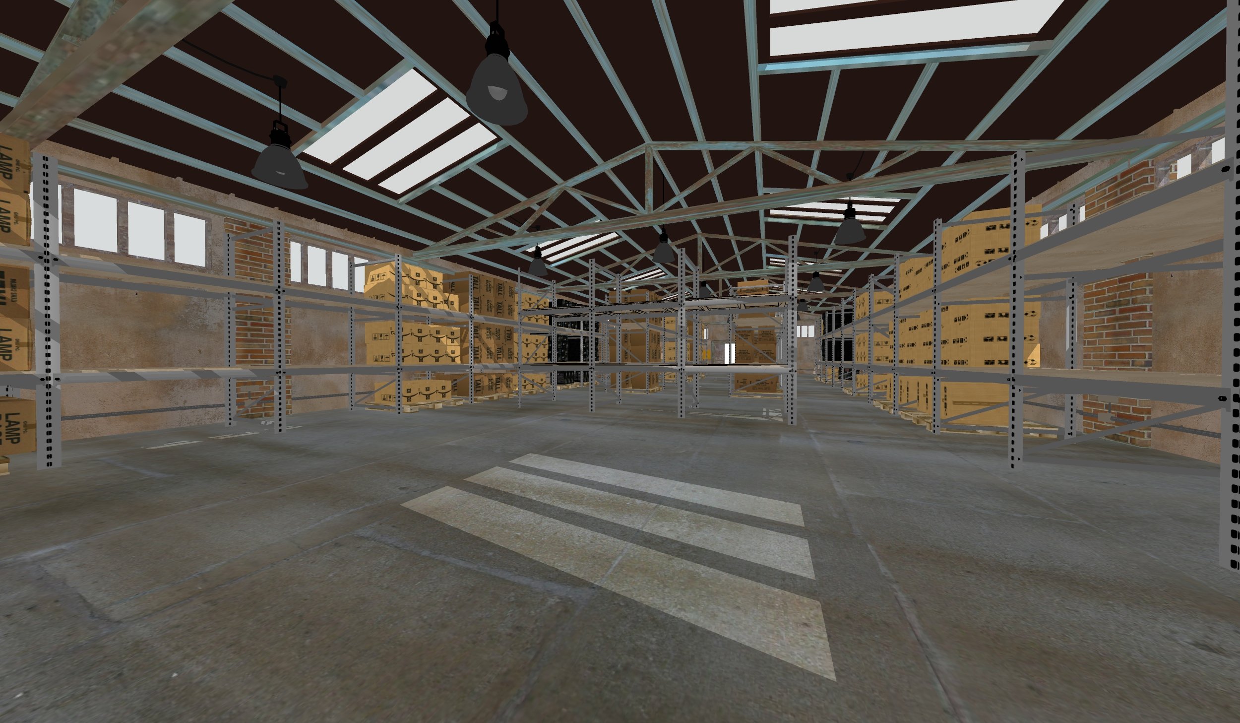
MapSpacer takes the roof off to show the interiors of your space
MapSpacer is a new feature that creates 3D renderings of the interior of buildings, allowing you to provide a spatial perspective of your space that might be lost in mere pictures. It has the potential so show the different ways your space can accommodate the needs of a specific convention or conference, virtually. The feature will allow the user to toggle between floors, making interactive 3D renderings of entire buildings a new possibility. This could be ideal for hotels or hospitals as an asset to present to guests and attendees.

Custom data integration enhances event experiences
The downside of hosting major events can often be the impact of having a high volume of people traveling to and congregating at one single location. In order to mitigate the impact of traffic, congestion on guests and attendees concept3D enables one to show public transportation schedules or live feeds of the event space as part of the interactive map. The data that concept3D is able to integrate into their maps is quite diverse and not limited to the aforementioned examples.


Combining the power of Esri with the aesthetic of C3D to produce one-size-fits-all maps
Esri provides the benefits of highly analytic and detail oriented mapping software. Esri can be used to map traffic patterns, garbage pickup, construction schedules, but they often lack the visuals aspects that concept3D is notorious for. By incorporating the depth of Esri capabilities into 3D interactive maps, you can now use one single map that can be used to show off your campus to the public, but can also be used internally to manage your facilities.
To learn more about how C3D is working with Esri - click here
Wrap-up
Concept3D’s has created features that cater nicely to the demands of many sectors of the hospitality industry. There’s a fit for every need one might have.


